Exploring the Great Rann of Kutch, Gujarat

The word “Rann” means “desert” and as the name suggests, “Rann Of Kutch”, located in Kutch district of Gujarat is an extension of the Thar Desert, but the difference rests in the fact that it is primarily a “salt desert”.

The Rann of Kutch, in India is broadly divided into two parts – the Great Rann & the Little Rann of Kutch. Situated at the very edge of Indo-Pak border, the distinctive landscape of the Great Rann offers a wondrous trip for tourists & travelers alike.

The vast expanse of white has loads to offer.

Hold on! The relief features characterizing the Great Rann are splendid since it is an amalgamation of boundless salt stretches, expansive arid desert plains, beautiful hills overlooking the Arabian Sea and islands surrounded by the huge Kutch Lake.

An ideal trip to the Great Rann of Kutch shall necessarily cover- stays at Bhuj & Dhordo along-with a visit to the adjacent Salt Desert that hosts the Rann Utsav; a visit to Kalo Dungar hill which is the highest point of Kutch; & most importantly a drive or ride through the “Road To Heaven” cutting across the vast Kutch Lake – to time travel back to the ancient Harappan city of Dholavira located at the island of Khadirbet.

Winter (November – February) is the best season to explore the Rann.

Here’s a your ultimate travel blueprint for a trip to the Great Rann of Kutch–
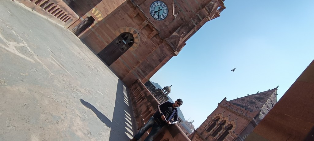
Bhuj

This city serves as the headquarters to the largest district in India i.e. Kutch. A day or at the most two in Bhuj is sufficient to explore this old town rich in heritage and tradition.

The Smritivan Earthquake Memorial & Museum is a must visit site in Bhuj. This large museum offers lots to explore and to learn about. Smritivan was raised in memory of the victims of the devastating earthquake which had struck the city in 2001. The museum offers “Seven” galleries to be explored which provides a detailed walk-through the creation of Earth, evolution of landforms, life, human beings, cultures, and through ancient civilizations mostly dwelling on the Indus Valley civilization. The museum also deliberates on modern history and developments in science & technology. Just adjacent to Smritivan is the Bhujia fort situated atop the Bhujiyo Dungar or hill. Experiencing sunset atop this hill is a beautiful experience as well.

Tourists interested in history, particularly the colonial past of this country may visit the Prag & Aina Mahals. Do visit the Kutch museum if you are interested in the tradition, heritage, and local tribal lifestyle & cultures of Kutch district in India and also of the Sindh province of Pakistan. Temple-goers and students of architecture must necessarily visit the Shri Swaminarayan temple in Bhuj.

An evening stroll around the beautiful Harmirsar Lake and a bit of shopping at the local market places should be an apt way to conclude your trip to Bhuj.

Then arrives the day next and one is ready to venture into the phantasmagorical landscape of the Great Rann of Kutch.

Prag Mahal, Bhuj

The Rann Utsav site & the gateway to the Safed Rann (the salt flats), Dhordo

The village of Dhordo is quite well-known thanks to the world famous Rann Utsav. This hinterland owing to its proximity to the Indo-Pak border necessitates tourists to obtain permits from the authorities for visiting this place. Permits can be obtained both online and offline.

The village of Dhordo is located at a distance of about 86 kilometres from the city of Bhuj. Enthusiasts may also hire 2-wheelers or cars from Bhuj itself and self-ride or drive to the Rann.

The landscape starts to change and bares forth the arid desert as soon as the traveler leaves the town of Bhuj and approaches the countryside. Trees get out-numbered by short shrubs and bushes, and the yellowish soil sometimes seems red, sometimes pinkish as well as blackish. At multiple places the earth also gives way to whitish swampy patches which indicates high salinity.

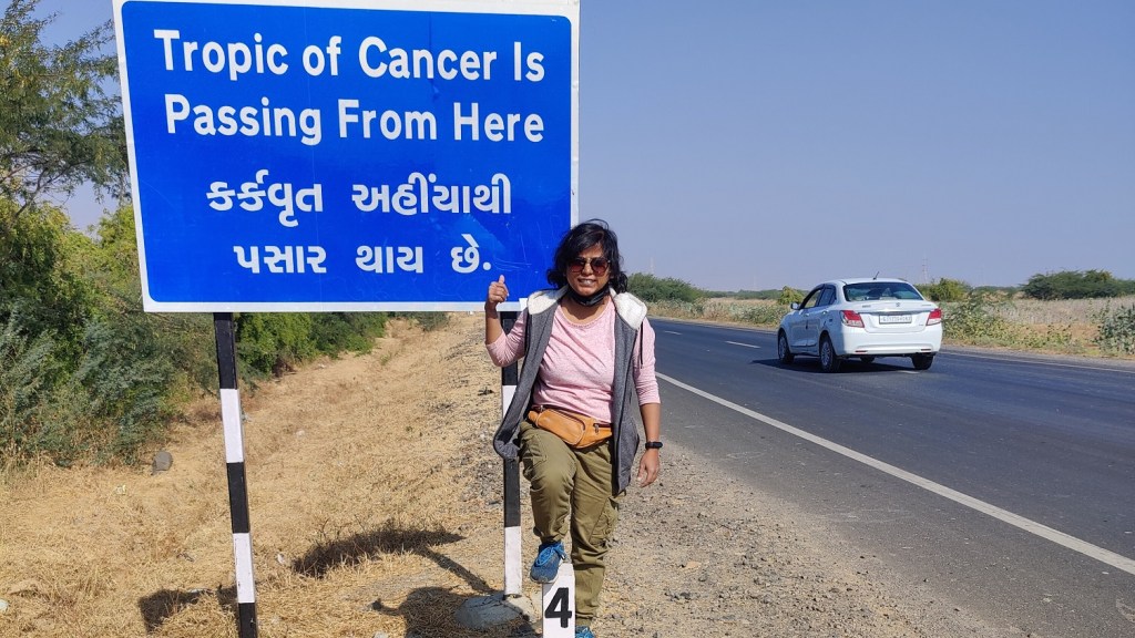
Suddenly in the middle of nowhere, there appears a board at the side of the tarmac, a careful glance nudges one to stop and realize that he or she is standing exactly at twenty-three & a half degrees north of the equator”i.e. at the Tropic of Cancer.

A few kilometres away, one comes across the Bhirandiara check-post. Obtain the permits to visit the White Rann at Dhordo incase you haven’t been able to gather it yet. Take a small break and enjoy the locally made hot “mawa” from the small shops located near the check post. For the uninitiated, “Mawa” is a Kachhi sweet-dish a variant of the more popular “milk-cake”.

The road which divulges leftwards from the Bhirandiara check-post leads to Dhordo. Dhordo is located at about 30 kilometres from the Bhirandiara check post. On your way to Dhordo, you will get to see “Bhungas” – round shaped mud huts with thatched roofs. These traditional mud-houses are fairly earthquake resistant and help in keeping the interiors cool during the ruthless summer months while providing warmth during the winters. One also passes by several nomadic bands walking past along with their herds of cattle, mainly sheep & camels.

Dhordo offers lots of stay options; and depending on preference and budget one may choose a resort or a camp-site. Nearby villages offer several homestay options as well. Staying at a Bhunga or a tent in a hotel or a campsite near the check-post, serving as the gateway to the expansive salt marsh is bound to be a great experience.

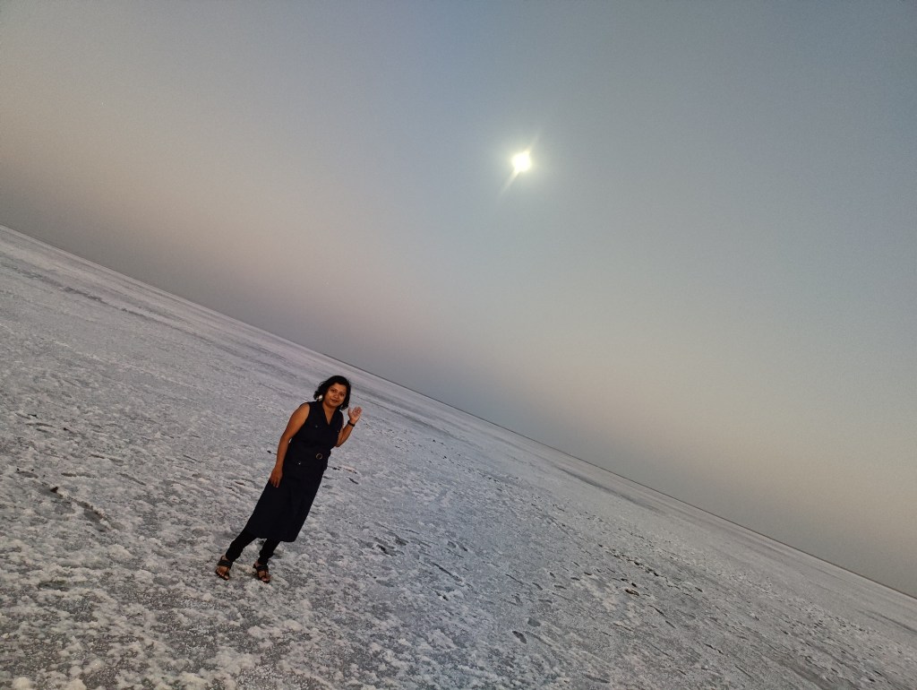
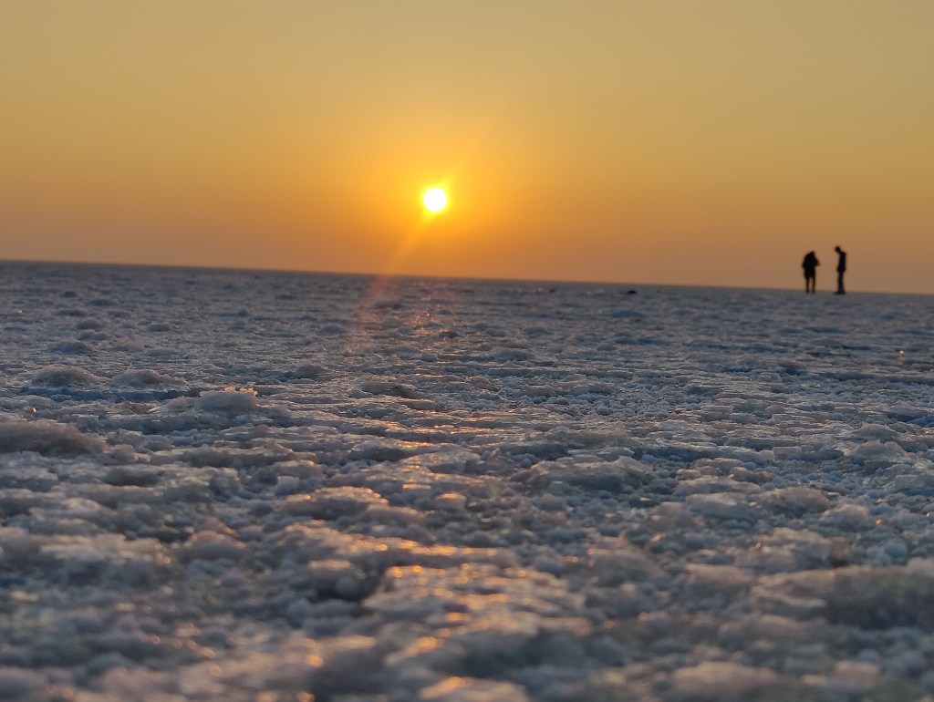
The focal attraction of the Rann Utsav is the unending stretch of white desert. Experiencing the setting Sun and the rising moon at dusk is an indescribable affair. The sight is absolutely mesmerizing. Walking on the dried up ocean bed covered fully with layers of hardened salt flats compels one to ponder over the beauty of existence.

The horizon remains unfathomable since it’s white all around. The best time to visit the White desert is during the full moon phase since it is during this phase that the desert reveals its full glory.

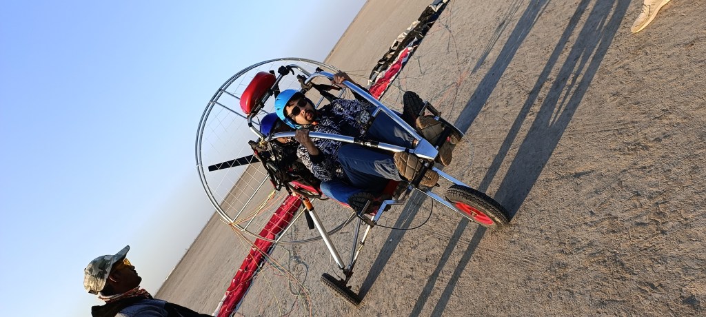
Tourists can indulge in various adventure sports activities like Paramotoring, Hot-air ballooning, ATV rides etc. One may also enjoy a camel safari. The view of the white expanse, camouflaged horizon along with the view of the setting sun and rising moon at dusk or the rising sun and setting moon at dawn is a sight to behold.

In the evening, the mela ground in Dhordo is a nice place to hang out, taste authentic Gujarati cuisines, and splurge on traditional Gujarati dress and local handicrafts. You may also indulge in the folk performances at your respective resorts & camp sites.

Hold on! The night is not yet over. It’s full moon and you must venture into the White desert at the midnight hour to soak in the burning white of the moon-blanched land and most importantly to promise to come back the next dawn to hail the rising Sun.

at Dusk

at dawn

Magnetic hill & Kalo or Kala Dungar

The next day tourists can enjoy a day trip to a nearby place called Kalo Dungar (black hill) and some other sites as well if time permits. The word “Dungar” means a hill or a hillock. Kala Dungar is the highest point in Kutch.

The place is located at a distance of about 40 – 45 kilometres from “Dhordo” and may take an hour or at max two to reach. Best way to reach Kalo Dungar from Dhordo is by traveling through the Gujarat state highway which connects Khavda with Dhordo. Though it is currently a single lane highway through which salt ferrying trucks navigate day in and day out, but the beauty of this highway lies in the fact that it runs through a beautiful sand desert. You may also find one or two small sarobar in between, frequented by migratory birds, mainly “flamingos”.

The final stretch to Kalo Dungar passes through a magnetic hill, which is a unique experience in its own way. Do stop for some time at this place to get a first hand experience of anti-gravity pull.

On reaching Kalo Dungar pay a visit to Dattatreya Mandir if you wish and then walk or take a camel ride till the top of the hill. It’s better to take the hike and on your way listen to Gujarati or Sindhi folk music sung by local fakirs.

The hilltop offers a majestic view of the Great Rann of Kutch, the Arabian Sea & its long distinct coastline marked by both sand and salt flats, and the adjoining hills.

Kalo Dungar is situated at a distance of about 52 kilometres from Indo-Pak border and one can spot through binoculars the strategically important India Bridge, India’s last village & border outposts, and the Indo-Pak border.

Tourists may also visit India Bridge, however a visit to this place solely depends on permission from the paramilitary or defense personnel present at the check-post.

Road To Heaven & Dholavira

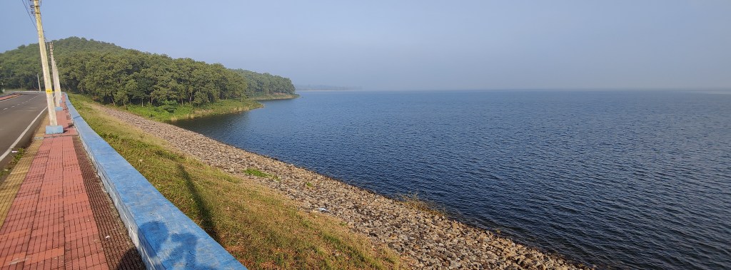
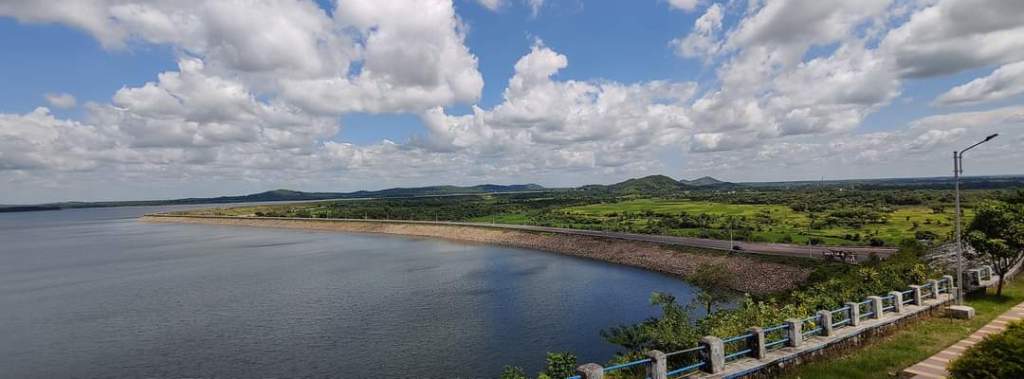
Dholavira is the fifth largest Indus valley Civilization site. This ancient city is located in the island of Khadirbet in Rann of Kutch and is surrounded by the Kutch Lake.

The best way to reach Dholavira from Dhordo or Dhordo is via the scenic Road to Heaven i.e via the Aadhav – Dholavira road after crossing Bhirandiara or Khavda. If you are traveling from Dhordo then you may skip Bhirandiara and directly reach Khavda through the state highway.

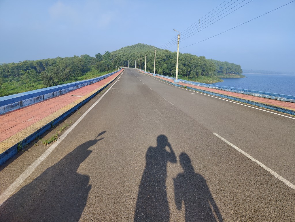
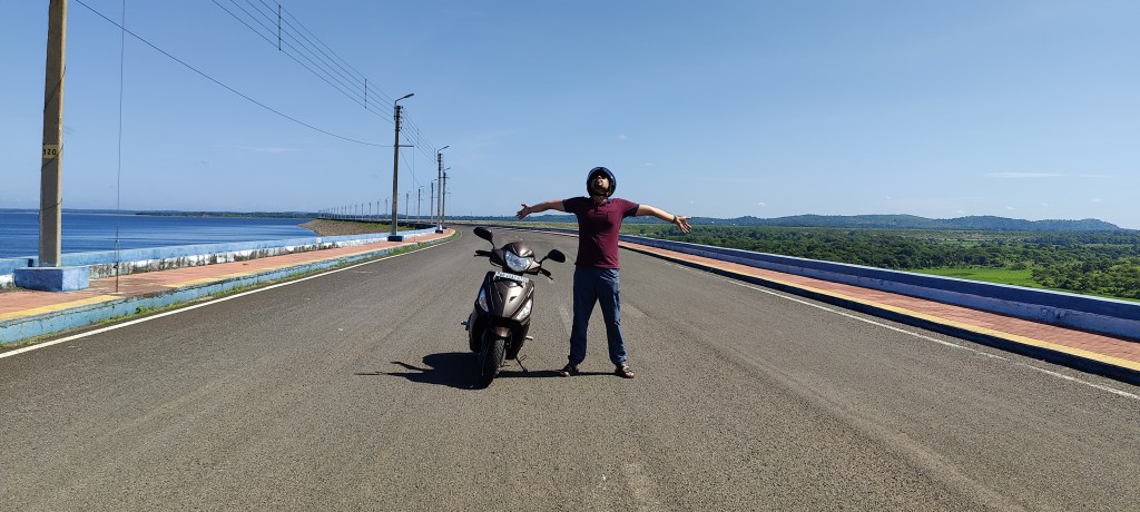
Road to Heaven is a 30 kilometres long stretch which cuts across the Kutch lake and connects the mainland with the island of Khadirbet famous for the UNESCO World Heritage site i.e. Dholavira. As the name suggests, the ride through this heavenly road is truly enchanting and hypnotic.

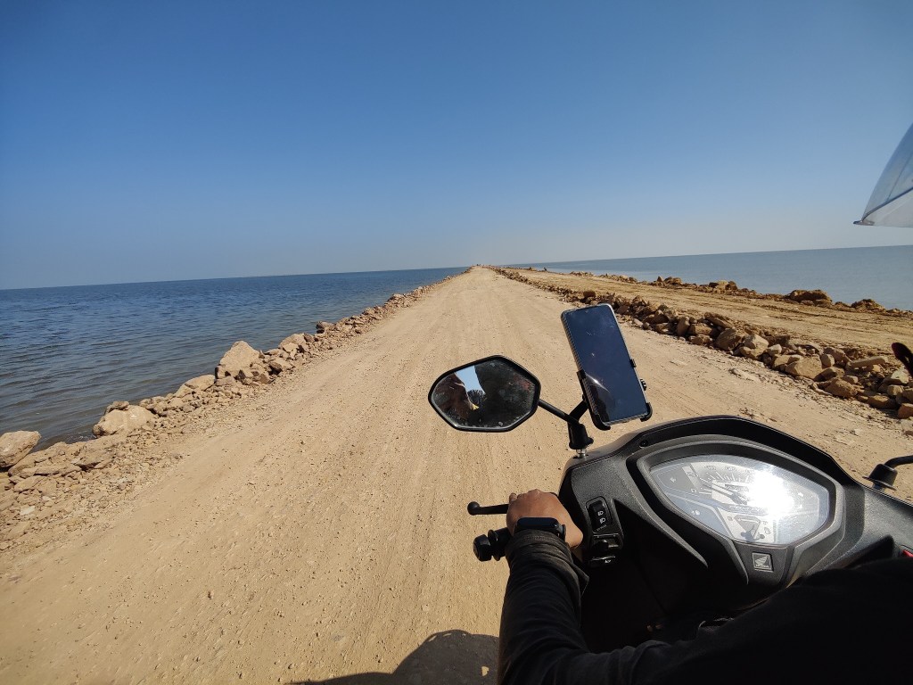
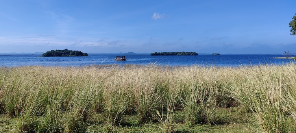
The traveler gets captivated by the view of the vast lake on both sides of the road and gets enthralled by its nothingness. The journey seems unending and the view awe-inspiring. Here one gets to see lots and lots of flamingos and it is due to their reflection on water, topped with the presence of salt that at places the crystal blue lake turns pink.

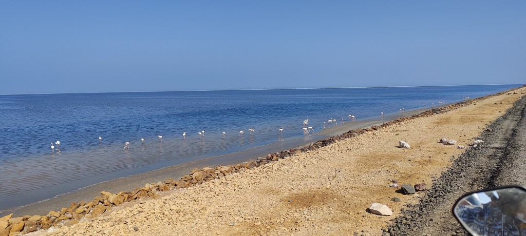
flamingos wading the shallow waters of the Kutch Lake

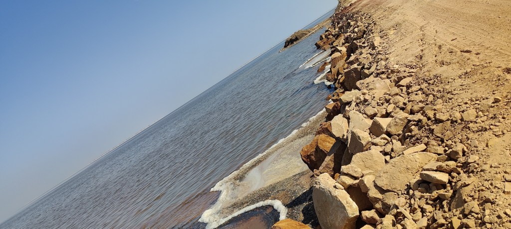
After a certain point, the lake water gives way to dried up salt bed and the entire landmass turns absolute white. It is noteworthy that this part of the salt desert is a million times better than Dhordo and is still majorly untouched or unexplored.

Caution! The road is at present under construction and remains mostly deserted. The stretch is also devoid of any shop or fuel station or houses hence careful and safe driving or riding is required. Most importantly night travel through this route must be avoided.

Dholavira has ample stay options and a two night’s stay at this remote island is enough to unwind, learn and reconnect with our origin and evolution.

Places to be explored in Khadirbet Island

Kotada Timba i.e. the ancient metropolis of Dholavira

This heritage site is an archaeological marvel which lays bare the engineering genius of the Indus Valley people. The town planning, and most imperatively the water conservation techniques, reservoirs & drainage system that the kingdom of Dholavira showcases makes one wonder and ponder on the greatness of humankind. One gets to learn about two prominent rivers Manhar & Mansar and how the water from these streams were utilized for general usage. The ruins uphold a very organized societal & administrative structure.

It is better to take a guide to better explore this place.

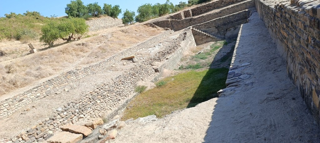
Archeological site at Dholavira

Wood Fossil Park

At a distance of about five kilometres from the Harappan site, lies a wood fossil park where one can get amazed at the site of Jurassic or pre-historic era fossils as old as 160 million years.

The view of the Kutch lake, coast line and the distant Bhanjano hills is just inexplicable.

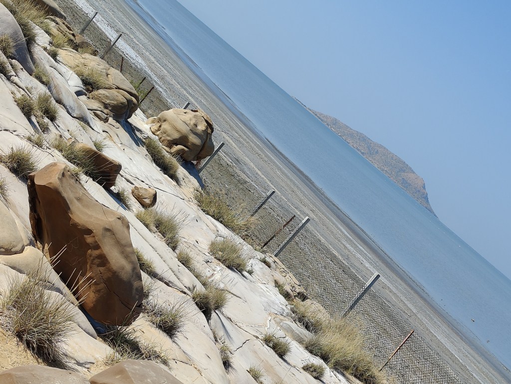
at Wood Fossil Park. The distant tilla visible is the beautiful Bhanjano Hill

Near to the fossil site lies a sunset view point and a small mandir maintained by the paramilitary forces.

Chipper Point

This point is located atop a hill and is actually a jutting or protruding rock which imparts a dangerous beauty to its admirers. It is advisable not to step into or tread to the edge of this rock. This point or rather the entire edge of this hill feels as if it has all of a sudden broken down and opened up to a dried up sea with a long distinct shoreline and unending salt flats. The view from Chipper Point seems incredible at dusk.

Stay Options at Dholavira or Khadirbet Island

The island of Khadirbet more popularly known as Dholavira has ample stay options.

If you are entering this island through the Road To Heaven and want to visit the Harappan Metropolis and Fossil park at first then book your stay near to it. Rann Resort Dholavira just at the terminal point of Road to Heaven is a great property and has a wonderful access to the beach i.e. the beautiful White Rann which in turn gives way to the Kutch lake. However, the property is not that budget friendly especially if you are visiting this place during the full moon phase.

More economical options can be explored near to the other side of the Khadirbet Island which falls near to Chipper Point. The villages of Ratanpar, Amarapar & Ganeshpar in the island offers good stay options in the form of resorts, hotels and homestays. Khadir Homestay Resort is a good option to stay as well. The property gets a thumbs up due to the homely vibe that it lends to its boarders.

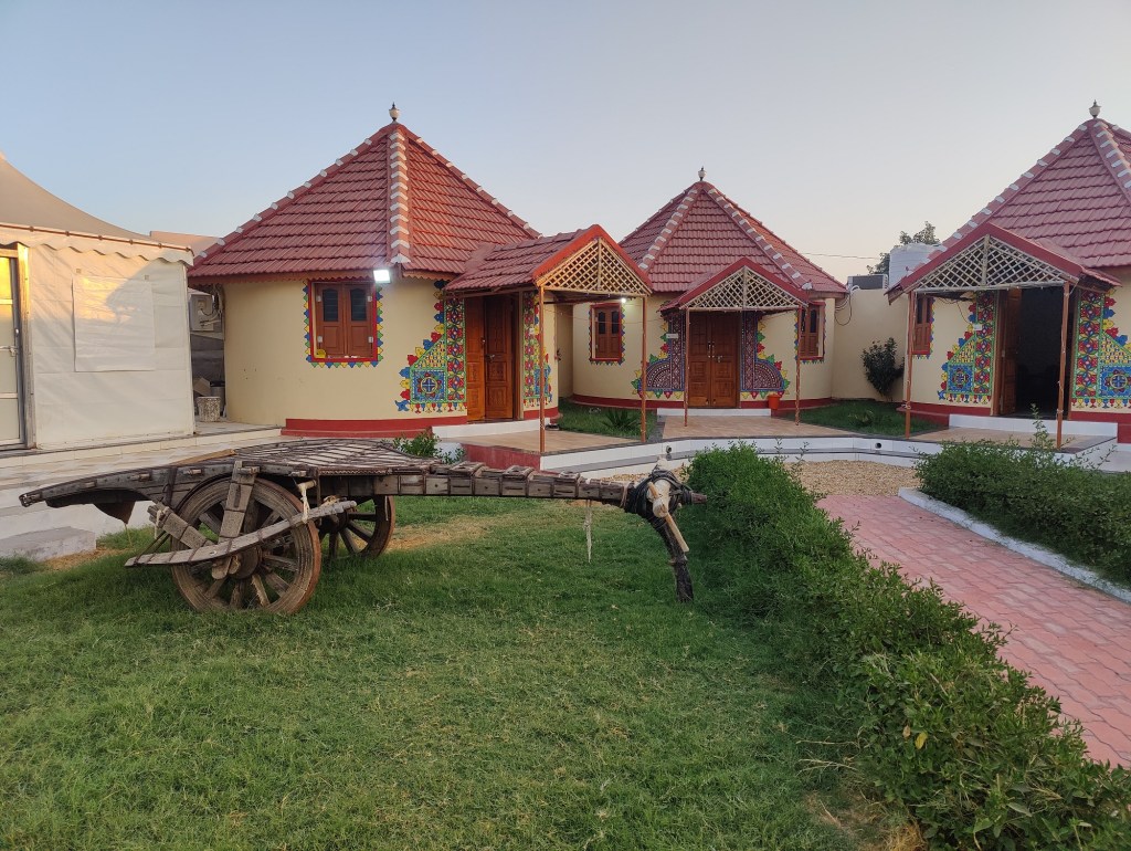
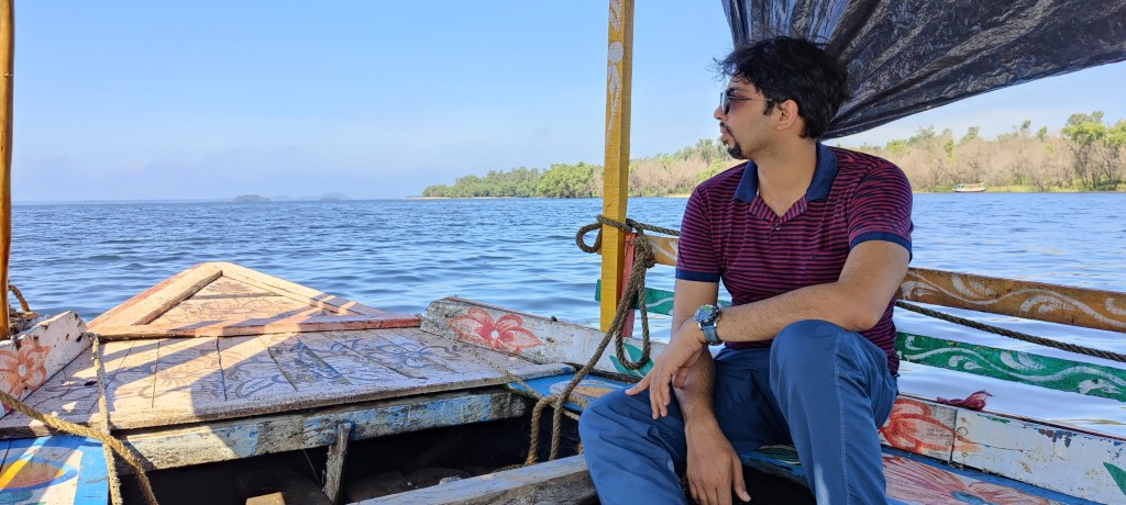
our stay at Khadirbet Island

Safari to the salt Desert during the mid-night hour

If you are at Dholavira, this is a must. Since this part of the salt desert is a lot better and harder, go for an expedition during the night into the Rann and get moon bleached incase it’s a full moon night or else spend your time star-gazing on a no moon or dark moon night.

Return

If you have already trudged the “Road to Heaven” while entering Dholavira, then for traveling back to Bhuj, you may take the Khadir Bet Road and then after reaching mainland take the Rapar – Bhachau highway which connects the other end of the Khadirbet Island with the major cities.

The ride through the Khadir Bet road also offers unhindered views of the White Rann. The road also runs across the dried up Kutch lake for a distance of about 8 kilometers presenting a perfect way to bid adieu to the Great Rann of Kutch.

The opportunity to travel backwards right from the Indus Valley civilization era till the pre-historic period and then to return back to present day makes the trip to Dholavira unprecedented.

The unparalleled relief features of the Great Rann inclusive of – vast expanse of salts, arid grounds, and rugged hillocks overlooking the Arabian Sea and its encroaching waters leading to the formation of the Kutch Lake truly justifies the tagline “Kutch Nahi Dekha Toh Kuch Nahi Dekha”.


A weekend trip to Mukutmanipur & Jhilimili under Bankura District of West Bengal

Travelling & riding have always been my liking. The fondness of late has multiplied, thanks to the new era of travel & moto vloggers, and their narrations in Youtube. These modern day explorers rather wanderers have obviously inspired commoners like me to seek some travel & adventure amidst the mundane routine.

Last year in July, 2021, with a heavy heart I finally bade adieu to my old cranky scooter, a Kinetic Zing Kine (bought back in 2007) and purchased a new Hero Maestro Edge 125. The old Zing Kine had been my companion since my first year in college. We shared a great bond in the sense that there have been times when I had to drag it and times when it did the same to me, but mostly, I admit, that the latter had been the case. The Kine was more of a stubborn and snobbish type because it allowed itself to be ridden just by me & its real financier, my dad, for I have often experienced its outright refusal to churn the engine when others have tried to self or kick start it. Jokes apart, I really do wish that the red scooter of mine gets well treated by its new owner for the rest of its dear miles, for my days with the Zing Kine will forever be etched in my memory.

However, thanks or may be not, to the ever increasing fancy of riding and travelling, I had to welcome my new scooter hoping it will take me to places near and far, to “Untrodden Boulevards”.

The new Maestro Edge with its better power, torque & sound, kept urging me to plunge into a short trip to some nearby place. Accordingly, with the scooter’s first servicing done, me & my husband decided to take a weekend vacay at “Mukutmanipur” & “Jhilimili”. Both the places fall under the jurisdiction of Bankura District in West Bengal. The location is about 165 – 175 kms from my native place Burdwan.

Mukumanipur is a village under Khatra subdivision of Bankura district. This quaint and picturesque village, also known as the Queen of Bankura, is situated at the conflux of Kangsabati and Kumari rivers. The place is famous for the earthen dam built across Kangsbati river, surrounded by dense forests and lush green hills.

us

We visited Mukutmanipur & Jhilimili in late September, 2021. September is the month which marks almost the end of the hot & humid rainy season and beckons the autumnal atmosphere thereby radiating an embalming, euphoric yet nostalgic vibe.

Day-1 – Ride to Mukutmanipur

As planned, we started our ride early in the morning and took the National Highway (also a part of the Asian Highway network) to reach Bankura district via Durgapur.

We rode past the breathtaking Durgapur Barrage built across the Damodar river and no sooner had we entered Bankura district, the traffic at and the barren surroundings of the wide National Highway gave way to the narrow but quiet State Highway guided by greener pastures and forest covers. The scenery grew soothing, the tire turned pleasing, morales kept soaring, while the forest cover continued expanding & temperatures started reducing with every passing mile hinting at a memorable trip ahead.

We took a short chai break, at a local road side shop and then resumed our journey towards Khatra Block. After a while we had our first view of the Kangsai river. The river, distant hills, surrounding environment and lifestyle, alongwith the sight of locals going about their daily chores like washing or bathing and the sandy banks and “kash” clusters imprints on the gazers mind the very image of “pally bangla” which is in stark contrast to the indifferent & chaotic city life.

We kept on riding for a few more kilometres via meandering roads amidst forests often forming arches for it’s travellers to pass through and sudden clearings giving way to either small villages or crop lands or kash fields. The white kash flowers spread across vast fields or croplands against the partially cloudy and at times sunny sky was particularly mesmerizing.

On reaching Mukutmanipur we were greeted by the river canal and beautiful hillocks, and before finally checking in at our hotel we took a short break to appreciate the surrounding. We had pre-booked our stay at a hotel named “Pink Rose”. It proved to be a lot better than what we had expected, for everything about the lodge right from it’s location to the decent facilities that it provided inclusive of the cleanliness, staff behaviour, eatery, spacious rooms and gardens were more than satisfactory.

We had booked our stay from the site www.bankuratourism.com and it charged us about Rs. 2000/- per night for a Standard Double Occupancy (AC) room. The location of the hotel, spacious clean rooms with attached balcony & neat washroom, well-maintained lawns and gardens is definitely commendable. Hotel Pink Rose is situated at about 10 minutes ride from the lock gates or bridge across the Kangsbati dam and offers a brilliant view of several of the Chota Nagpur hills both at its fore and backdrop. The hotel maintains a well-trimmed lawn and consists of a small poultry farm as well.

After checking in at the hotel and gulping down the wonderful view that the surrounding had to offer, we freshened up and had a sumptuous Bengali lunch with rice, dal, aloo-posto and deshi chicken curry served hot. A salubrious siesta followed suit and in the late afternoon we took a ride to the Kangsabati dam and the embankment area.

Sunset @lockgates – the river cutting through the hills

We passed by an elephant corridor as well. At the bridge or lock gates we were greeted by the deafening roar of the massive, freely-flowing, powerful river and were overpowered by awe. We then visited the road across the dam or embankment. This area is the most popular tourist spot in Mukutmanipur. However, since it was already late in the evening with slight drizzles we headed back to the hotel for hot cups of chai and pakora. The day’s riding had worn us out a bit and after dinner we sat back and relaxed till late night in the lawn. There was a slight chill in the wind and the silent night made us ponder and ramble about life and stuff.

silent night

Day-2 – Exploring Mukutmanipur & Jhilimili (Boat ride to Bonpukuria, short walk to the deer park & Musafirana view point, and ride to Laljal Devi Pahar)

We woke up early morning at around six and without wasting any time, kick-started the bike rather the day with a ride through the road over the dam. We must admit here, that the view that it offered is indescribable since mere adjectives won’t suffice. The road offers on one side the view of two most scenic rivers that I have known till date i.e the Kangsbati & Kumari rivers, while on the other side it offers unhindered view of the majestic lush green hills and forests.

early morning ride
confluence of the Kangsabati & Kumari rivers

The crystal clear azure waters of the Kangsabati river felt hypnotic and out of the world. This ride through the embankment itself was worth a million for us. The embankment road is about 11 kms long. At the other end we parked our two-wheeler and after visiting a local temple, signed up for a boat ride to a tiny village known as Bonpukuria situated on the other side of the river, to visit a deer park that it houses and some small islands in the middle of the river.

blue-struck

The boat ride through the confluence of the pristine & clean rivers Kumari and Kangsabati felt enchanting and exotic. After alighting at the other side, we gathered that the deer park is located about 2 kms inside and preferred walking towards the same.

mixed hues – view of the distant islands from Bonpukuria

Luck was at our side that day I guess, since our arrival coincided with breakfast time for the bevy. We enjoyed watching the herd huddle together and munch on. A little village girl accompanied us and provided bunch of certain leaves which according to her served as fodder for those four-legged creatures. She called at the herd and some of the younger lot befriended us for the food. While returning from Bonpukuria the boatman took us to an island where we were amazed at the huge canopy formed by trees encompassing & covering the entire small island.

On our way back to the hotel we stopped for a brief photo shoot right at the middle of the empty road facing the rivers.

On reaching the hotel we straight away mounted our backpack on the scooter and after enjoying the Bengali breakfast of luchi and aloo-dum, bade good-bye to the hotel staff and rode towards Jhilimili.

Jhilimili is a tourist spot in Ranibandh block under Khatra Sub-Division of Bankura. This quiet place is loacted at a distance of about 26 – 30 kilometers from Mukutmanipur and is mainly a forest area. It is adjacent to Sutan forest and both Jhilimili & Sutan are often referred to as “Baro Mile-er Jungle”.

Some of the spots that are worth visiting at this getaway are – Talberia Dam, Sutan Lake, Watch Tower and a place called Laljal Pahar and Mandir. Laljal Devi Pahar is located at the neighbouring Jhargram distirct of West Bengal.

One may either take the State Highway to travel to Jhilimili from Mukutmanipur or may travel through the embankment path itself and through the interior roads cutting across beautiful villages and Sutan forest. Both the routes are scenic, however the latter is of course less trodden but of greater thrill and beauty and eventually we opted for the same.

On our way we stopped at Musafirana View Point situated at a little tilla overlooking the confluence of the Kumari & Kangsabati rivers. The place offered a magnificent, spectacular and panoramic view of the entire region.

panoramic view from Musafirana

Riders are bound to fall in love with the undulating roads winding through forests, croplands & villages while travelling from Mukutmanipur to Jhilimili.

After this memorable ride we reached “Rimil Lodge” at Jhilimili for our stay there. This lodge is easy to spot and is located at the very lap of nature. The lodge is an ideal getaway for weekenders. It offers multiple options for stay, and one may opt for cottage or tents or tree houses (built on artificial trees of course) or simple standard rooms depending on the budget at disposal. We opted for the economical Standard AC rooms and it is worth mentioning that the room was indeed large with two nice balconies (one each at the front & back) and a sizeable wash-room.

the sprawling eco-tourism centre @ Rimil lodge @ Jhilimili

The expansive gardens, poultry farm and tall trees lend a natural green hood to the lodge and one can enjoy lunch, snacks and dinner right under these trees in the garden area. A peacock roaming freely in the eco-tourism centre is worth mentioning.

it’s my home

After checking in, we had a hearty, delicious & typical Bengali bhuribhoj and then took a short nap. It was a rainy afternoon and the forecast warned of cyclonic weather accompanied with thunderstorms. However, late in the afternoon the stormy weather subsided and as it left space for soft drizzles, our wandering spirits compelled us to visit Laljal Devi Pahar and Durga Mandir located at a distance of about 11-15 kms from Jhilimili. Laljal Devi Pahar falls under Jhargram District of West Bengal.

The ride to Laljal was through little unknown hamlets and to reach the actual place one has to leave the State Highway at some point and off-road till the destination. Since it had rained in the afternoon so we had to negotiate with muddy and rocky tracks to reach the temple site. This part was a bit thrilling. There was no mobile phone network & since it was already dusk and the track was a forlorn one running through forests, my mind was full with inhibitions and apprehensions. However, it is due to this that we kind of enjoyed the overall experience. While returning we stopped at the road side just to inhale & capture the diminishing reddish-golden hue of the setting Sun, overpowered by the onset of darkness brought forward by the cloudy yet cyanic sky.

dusky tinge

Back to the hotel and after dinner we had a lazy night stroll and finally signed off.

[A word of caution – the chow mein that we had at dinner was unpalatable, so incase you are visiting this place, opt for the authentic Bengali dishes which they serve best.]

Day – 3 – Early morning ride to Talberia Lake & Dam, and journey back to Burdwan

We woke up early and quickly rode off to explore the nearby Talberia Dam, another spot worth visiting. The place is about 6 – 7 kms from the Rimil Lodge. The trail leading to the spot passes through tribal villages and dense forests. The lake is located in a secluded area and offers an absolutely lung-friendly air and freshness. The leisurely or unhurried admirers may enjoy a quiet contemplation for a couple of hours by the lake, while the exuberant & adventurous ones may prefer to be lost while exploring the jungles, hillocks and adjacent water bodies. The view was just picture perfect.

Talberia lake and dam

Jhilimili to Burdwan is about 188 – 190 kms if one travels via Durgapur along the National Highway and since stormy weather & heavy downpour was predicted, we checked out early from the lodge. As has been praised all throughout this piece, the State Highway especially from Jhilimili to Khatra was splendid. It was as if the entire road cutting through deep jungles, hillocks & hamlets was just made for our ride. It felt as if we were passing through some beautiful hill station. Here, one must specially appreciate the government and local bodies for the well-constructed and properly maintained roads. The other praiseworthy feature is the extraordinary cleanliness exhibited by the roads, villages, water bodies and overall surroundings of these places. The simple & rustic lifestyle, the traditional Bengali and tribal cultures upheld by the natives or residents can be experienced at its best here.

miles to go
takeaway

On our way back we took breaks for chai and lunch, and though we were able to outpace the heavy rains and tempestuous climate for the most part, but it finally did overtake us in the open highway at some place between Durgapur and Panagarh. We parked the vehicle and wore raincoats and continued riding for some more distance lest the storm grows wilder. However, we had to wait eventually at a highway-side bus stop hoping for the rains to subside a bit. Subsequently, it did get sobered up to some extent and we resumed our ride towards Burdwan.

The overall experience had been great and undoubtedly Mukutmanipur is a great weekend destination for people staying in adjacent and nearby districts/cities/towns of West Bengal & Jharkhand.

check out our vlog series documenting this weekend trip – https://www.youtube.com/watch?v=S08_bS6xJD8&list=PLZ7h26c_EJUxRYzDY13wUdIjjudzTL852

A hike to George Everest Peak in Mussoorie

Autumn is considered as one of the best times for visiting the mountains, and not without reason. The climate is best suited for hikes or treks, and the crowd is also comparatively less. This is also the time when the weather is generally the most reliable, and the chances of scorching heat, rain or snowfall are minimal. The views of the mountain landscapes are also amazing.

Last autumn, we paid a visit to Mussoorie, one of the most popular and beautiful hill-stations of India. Located at a distance of around 40 kilometres from Dehradun, the capital of Uttarakhand, Mussoorie offers a plethora of options for staying and conveyance. We hired a scooter at a price of 700 rupees per day from Dehradun (though one can avail them from Mussoorie also) and managed to avoid a hole in our pockets. While researching about the places to visit in Mussoorie, we came across a rather interesting place, known as the George Everest point.

This was the place comprising a house and an observatory, from where Sir George Everest, the Surveyor General of India from 1830- 1843, carried out the Great Trigonometric Survey, one of the main objectives of which was to determine the heights of mountains in British-occupied territories. Mount Everest, the highest peak in the world, was named after him, posthumously.

We decided to visit Everest point on the second day of our stay at Mussoorie. We started our scooter with enthusiasm and took off for this point situated at a distance of 6 kilometres from the Mussoorie Mall Road. The smooth asphalt road devoid of cracks leading up to the Everest Point was in stark contrast to the potholes and cracks observed in city roads, and it seemed that our scooter too was excited to be our companion for this small trip. However, once we crossed Hathipaon, a village en route our destination, our scooter was faced with the challenge of some serious off-roading, although for a short distance.

Upon reaching the base of the Everest Point, we got to know that the actual spot, i.e., the house and the survey point would reveal themselves only after a hike of around an hour. There were various stalls around the starting point of the hike, mostly selling food items where groups of travellers gulped down freshly made ‘Maggi’ or a plate of hot momos to satisfy their tummies. Some of them seemed to have interesting conversations over cups of chai or coffee. Several two as well as four wheelers were parked at the starting point, which corroborated our research that this point was a major tourist attraction in Mussoorie.

We started hiking up the hilly path leading up to the survey point, and were greeted by tall forests of pine and deodar on one side, extending their branches to shake hands with us. The path, composed of ash- coloured stones arranged in concentric circles, transported us instantly to the colonial era. The weather was a bit foggy and the damp road seemed to be perspiring, thereby making it slippery, but could do little to curb our enthusiasm for reaching the top. After hiking for about half an hour, we came across a posh cafe situated on an expansive meadow. We noticed a signboard at the entrance to the cafe reading “Everest Base Camp” and couldn’t help but chuckle at the irony of having hiked only for half an hour along a beautiful fenced path to reach it. We ordered cold coffee to regain our lost energy after this short hike and were able to gain a lot more calories than we had lost.

We started again and were able to reach the house and the survey point after hiking for another quarter of an hour with our tired legs. The house was in a dilapidated state, and we couldn’t gain entry into it due to renovation work at that time (October 2021). Just beside the house was the Survey point, connected by a flight of steps just beside its boundary. We climbed up the Survey point and were mesmerised by the panoramic views of the surrounding mountains alongwith the Doon valley.

George Everest House .. (ongoing renovation work)

However, the thing that interested us the most was a hill standing tall at the right hand side of this house. The zenith of this hill, the Everest Peak, namesake of the highest peak in the world, was accessible via an hour long hike through a challenging path. Some hikers making their way back from the summit motivated us by saying that a visit to Everest point is incomplete without conquering the summit and savouring the awesome views offered by it. It was then that we decided to trek up to the top despite some initial inhibitions.

the trail leading upto George Everest peak

The initial stretch of the hike was not difficult at all since almost the entire path had proper cemented steps. However, these steps are quite narrow and it becomes quite scary when one looks down below and contemplates one’s future after a fall owing to a misplaced step or a slip due to lack of attention. A small mistake can send you tumbling down hundreds of feet and lead to sure-shot death. But the narrowness of the path is only one of the many concerns. The steps are broken at many places, and covered with loose rocks making this a treacherous route thereby raising the thrill element. We hiked our way up very cautiously for about an hour,  meeting other fellow hikers at times till we reached our final challenge. We had reached a place where finally the narrow stairs cut along the side of the hill gave way to a tabletop surface comprised of two further conical small “tillas”. The Buddhist prayer flags attached to ropes tied to these two “tillas” at either end gave us a surreal feeling. The higher amongst these two peaks/ tillas  is known as the Everest Peak. We decided to climb this one.

This climb was a bit difficult since this final route required some actual climbing along steep protruding rocks and boulders. We had to watch our steps and were dead tired by then. However, our exhaustion gave way to joy once we reached the top. The panoramic views of all the mountains near Mussoorie, along with the cool breeze was a treat to our senses. We cozied ourselves on some comfortable rocks and tried to soak in the beauty of the place. We reached the peak just an hour after noon, and the cool weather intermingled with the sunshine was the perfect time to spend some leisurely moments after a tiring hike. The Buddhist prayer flags fluttering in the wind along with the enchanting views evoked an ethereal feeling. However, we needed to descend as well, since we had other places in our “to-go” list, but the whole hike up and the time spent at the top left us craving for more.

atop George Everest peak

check out our vlog featuring this hike – https://youtu.be/xABjG292gFU